Marathon Course,
every big marathon course measured the same way.
Course maps, elevation, entry and race-day weather for the world's big marathons, in one place.

Why I built it
§ 01I'm training for Queenstown, and next year I'll be in the ballot for Sydney and the drawing for New York. When I went looking for the New York course, I wanted three things: a clear map, the elevation and a GPX file. I couldn't find them together.
Race sites show the map, running apps show someone's watch data, and the elevation figures never agree with each other. So I built one place that has all of it, for every big marathon, and measured every course the same way so the numbers mean the same thing from one race to the next.
The measurement
§ 02 — the bit that took longestOne method, every course
Watches and race websites rarely agree on how much a course climbs. Here, every course line is resampled every 25 m, and each height comes from the best bare-earth terrain model for that country: lidar in the Netherlands, New Zealand and the US, Sonny's model across Europe.
Bridges and tunnels, which terrain models read wrongly, are found from OpenStreetMap and straightened. Each figure carries its source and the date it was checked.
bare earth, not GPS
What's on it
§ 03Map, profile, fly-through
A map, the elevation profile and a 3D fly-through. Drag along the profile and the marker follows you around the map.
How to enter
Ballots, qualifying times, fees and dates, so you know what it takes to get a start line.
The morning, planned
Start times, cut-offs and the morning's schedule.
Thirty years of race mornings
What the weather has actually done on race morning, year after year, from ERA5 reanalysis.
Every course on a globe
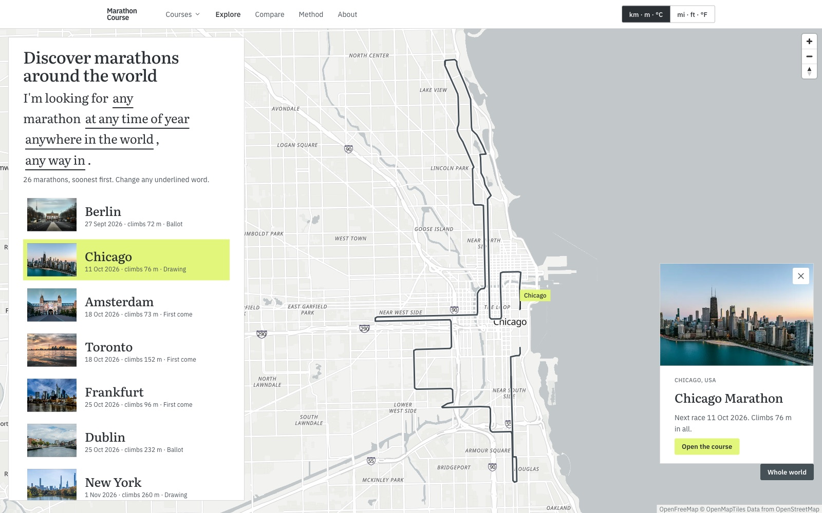
Spin the world, filter by season, region or way in, and fly down into any course.
Two courses side by side
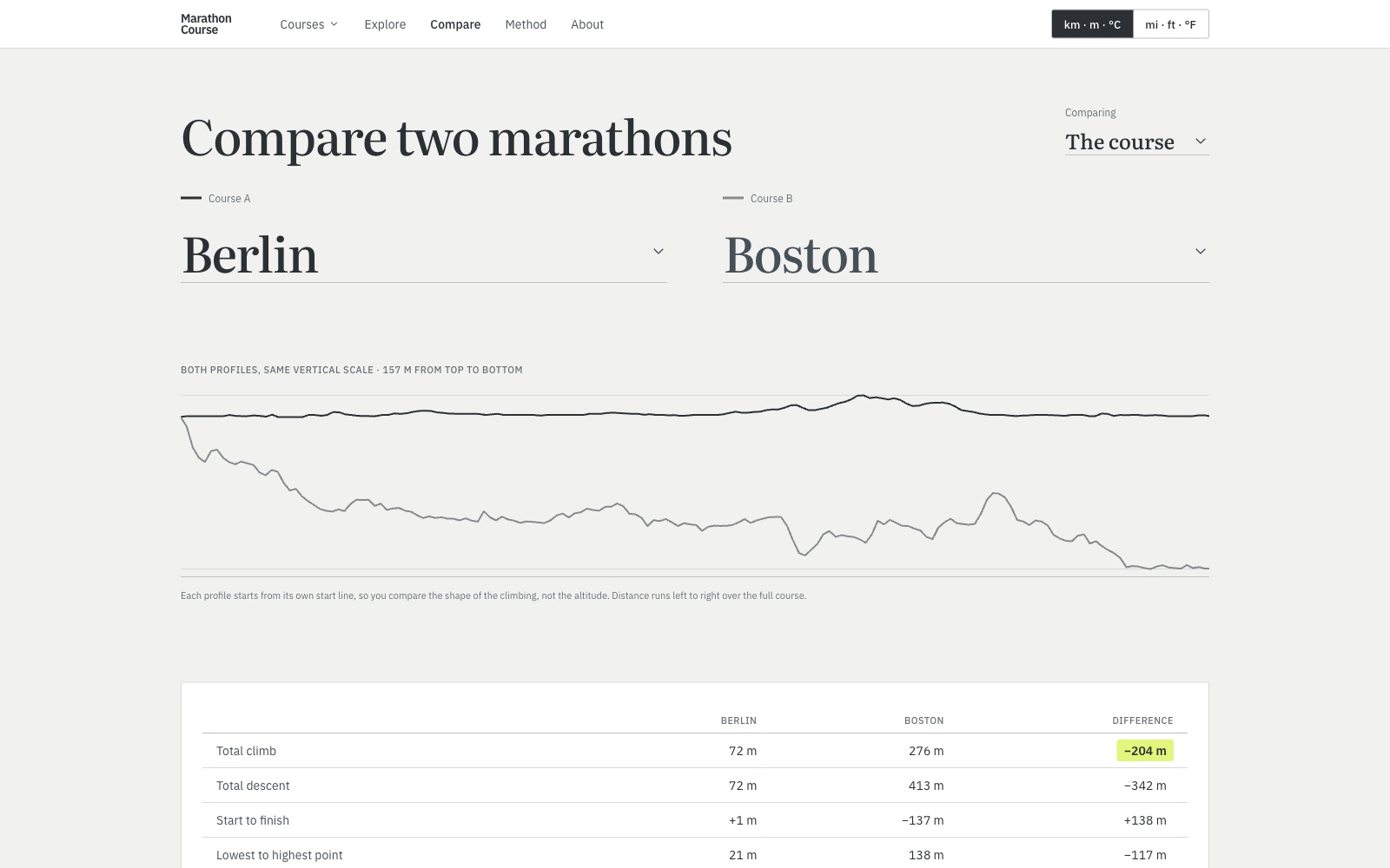
Both profiles on the same vertical scale, with the climb, descent and weather set out next to each other.
GPX, print, embed
A GPX file for your watch, a printable course sheet, and an embed for your own site.
Your units, everywhere
Km or miles, °C or °F, switched once and carried across every page.
A look at it
§ 04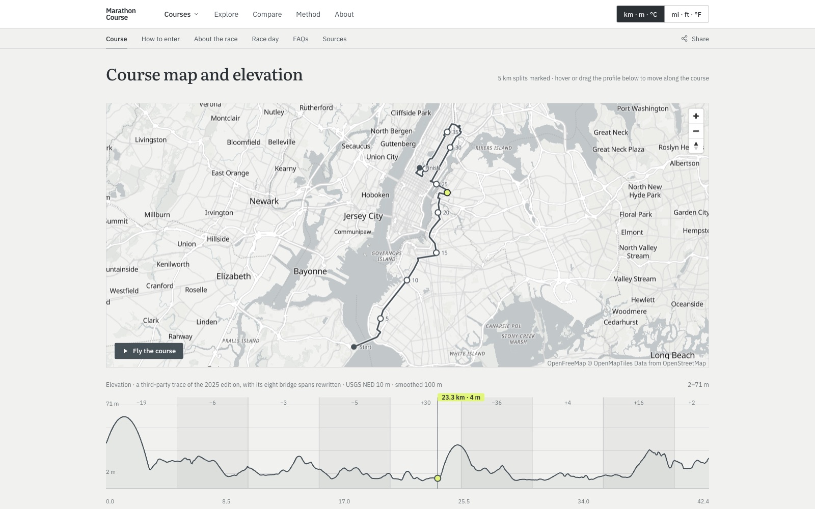
Try it here
§ 05 — the embed, liveEvery course comes with an embed that any running club, race or blog can drop into its own page. This is the real thing, not a screenshot: Queenstown, the one I'm training for. Drag along the profile to move around the course.
How it's built
§ 06 — the stackA Python pipeline does the measuring: it fetches each course line, samples it against the country's terrain model, corrects bridges and tunnels, and pulls thirty years of race-day weather from ERA5.
Astro turns that into a static site, with MapLibre for the maps, so pages open fast and work without much script. It's hosted on Cloudflare. A small Worker rebuilds it weekly, so a race that's been run drops its countdown without anyone touching it.
Logo & blurb
§ 07 — for press & listingsWriting about Marathon Course, or listing it somewhere? Grab the logo and copy from here rather than screenshotting the site.
Marathon Course is a free guide to the world's big marathons. Every race has its course on an interactive map with a 3D fly-through, an elevation profile, a GPX file and a printable course sheet, plus entry details, the race-day schedule and around thirty years of race-day weather. Every course is measured the same way, so the numbers can be compared from one race to the next, and each one says where it came from.